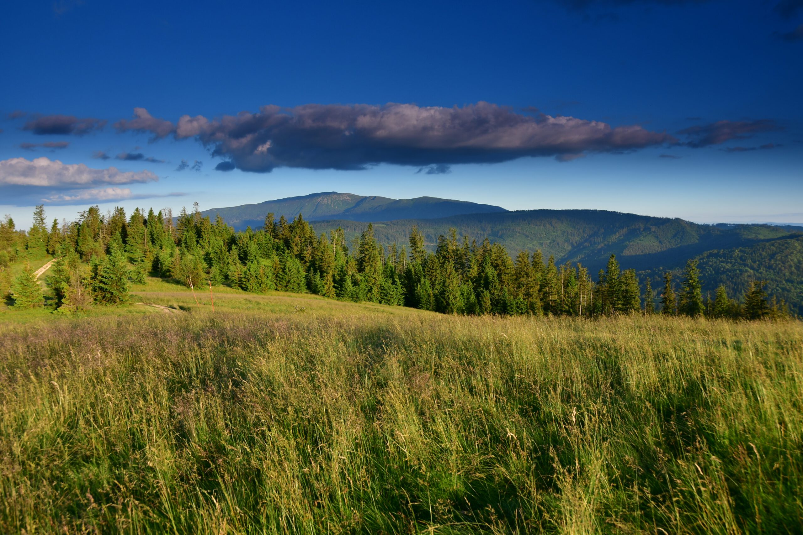
The biggest attraction of the Podbabiogórze, common for the Polish and Slovak part of this border region, is Babia Góra – the highest peak of the Western Beskid Mountains (1725 m above sea level). Its ridge runs along the state border and the European watershed (the drainage basin of the Baltic Sea and the Black Sea). Both on the Polish side (Babia Góra National Park) and on the Slovakian side ( Horná Orava Landscape Park) it is under natural protection.
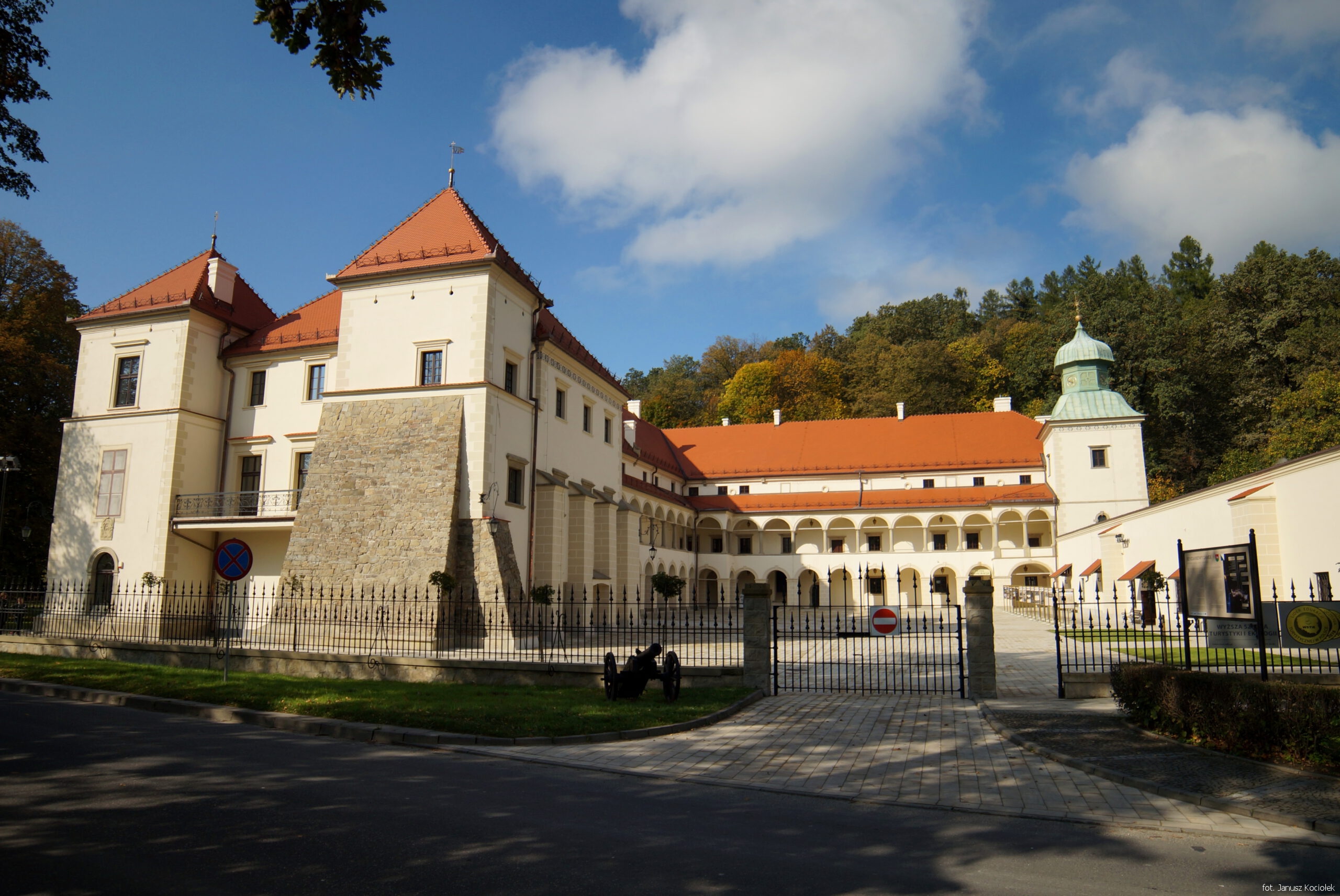
The Renaissance castle is called ‘Small Wawel’. Its oldest part comes from the second half of the 16th century. The Municipal Museum and the Higher School of Tourism and Ecology have their seat in the castle. There is also a hotel and a restaurant. Next to the castle there is a landscape park with an orangery and a ‘Gardener's House’ with an ethnographic exposition.
GPS: 49°44'47.4"N 19°36'05.2"E 49.746506, 19.601430
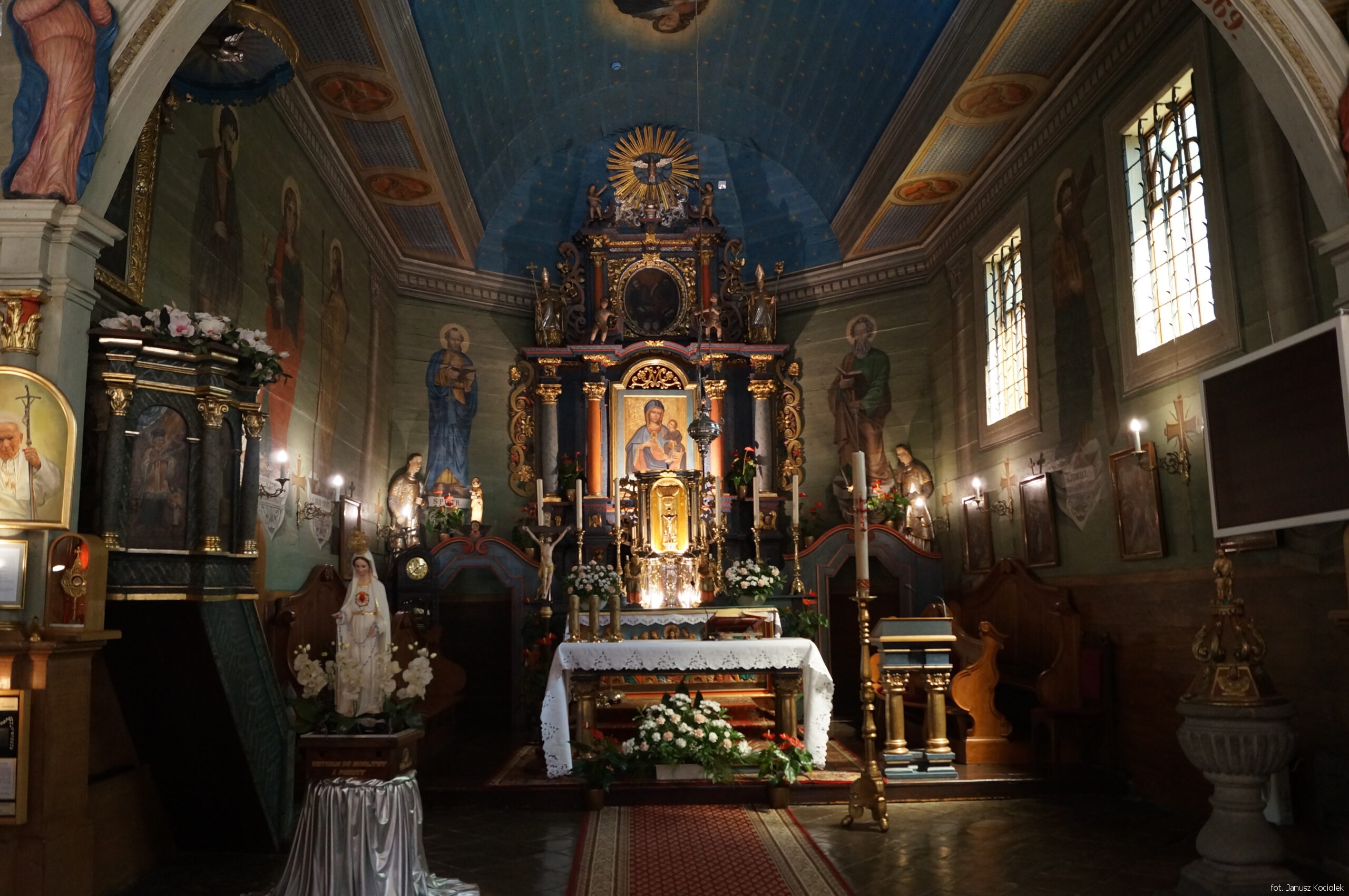
The Church of St Apostles Peter and Paul, erected in the years 1789-1791, is one of the most valuable monuments of wooden sacral architecture in Lesser Poland. The object on the Trail of Wooden Architecture.
http://www.parafia-lachowice.pl
GPS: 49°42'50.0"N 19°28'26.8"E 49.713876, 19.474100

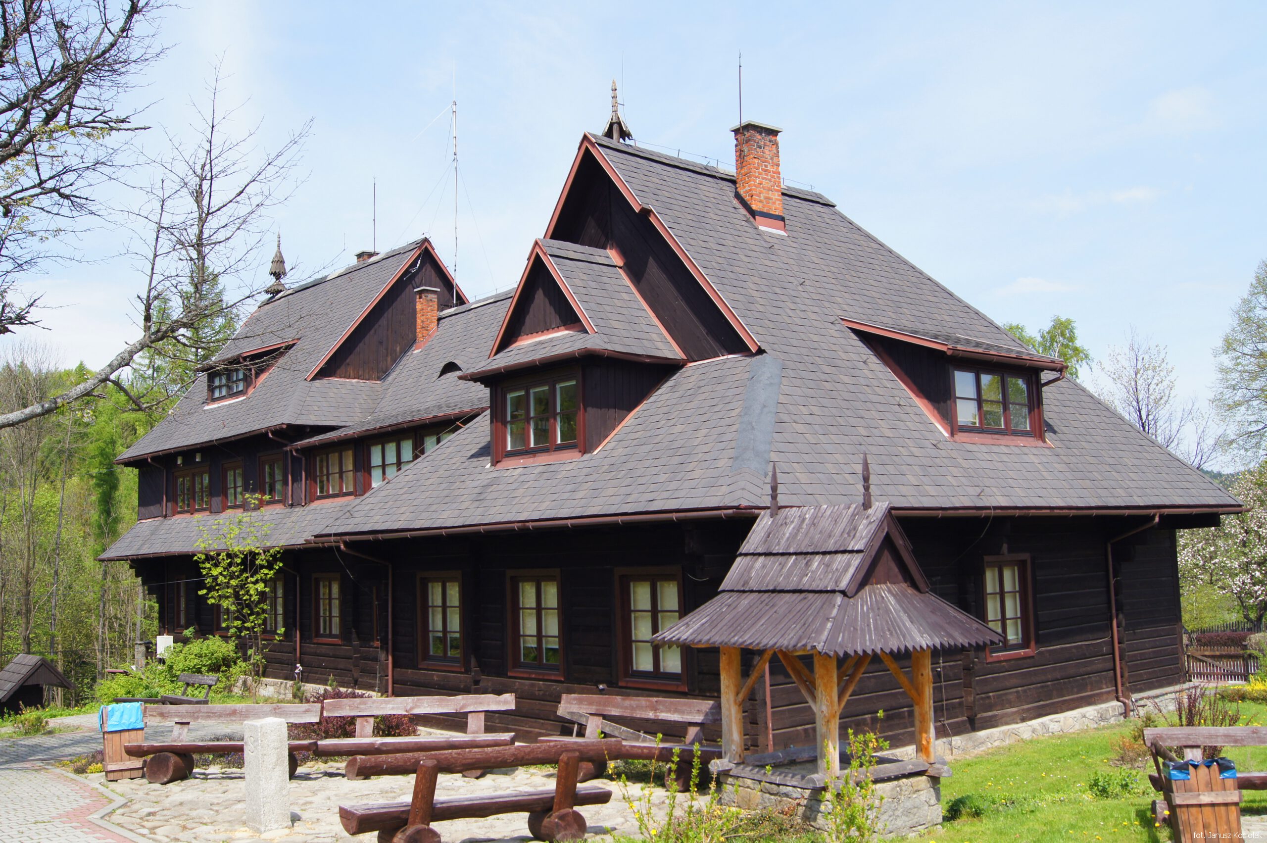
Church of St. Apostles Simon and Jude, built in 1760-65, one of the largest timber-framed churches in the Beskids. Object on the Trail of Wooden Architecture.
GPS: 49°41'49.6"N 19°52'20.1"E 49.697098, 19.872236
At the Permanent Exhibition visitors can learn about nature, tourist values and cultural heritage. The Babia Góra Plants Garden occupies an area of approximately 11 acres. It is divided into quarters housing nearly 200 plant species.
GPS: 49°36'42.7"N 19°31'05.3"E 49.611850, 19.518145
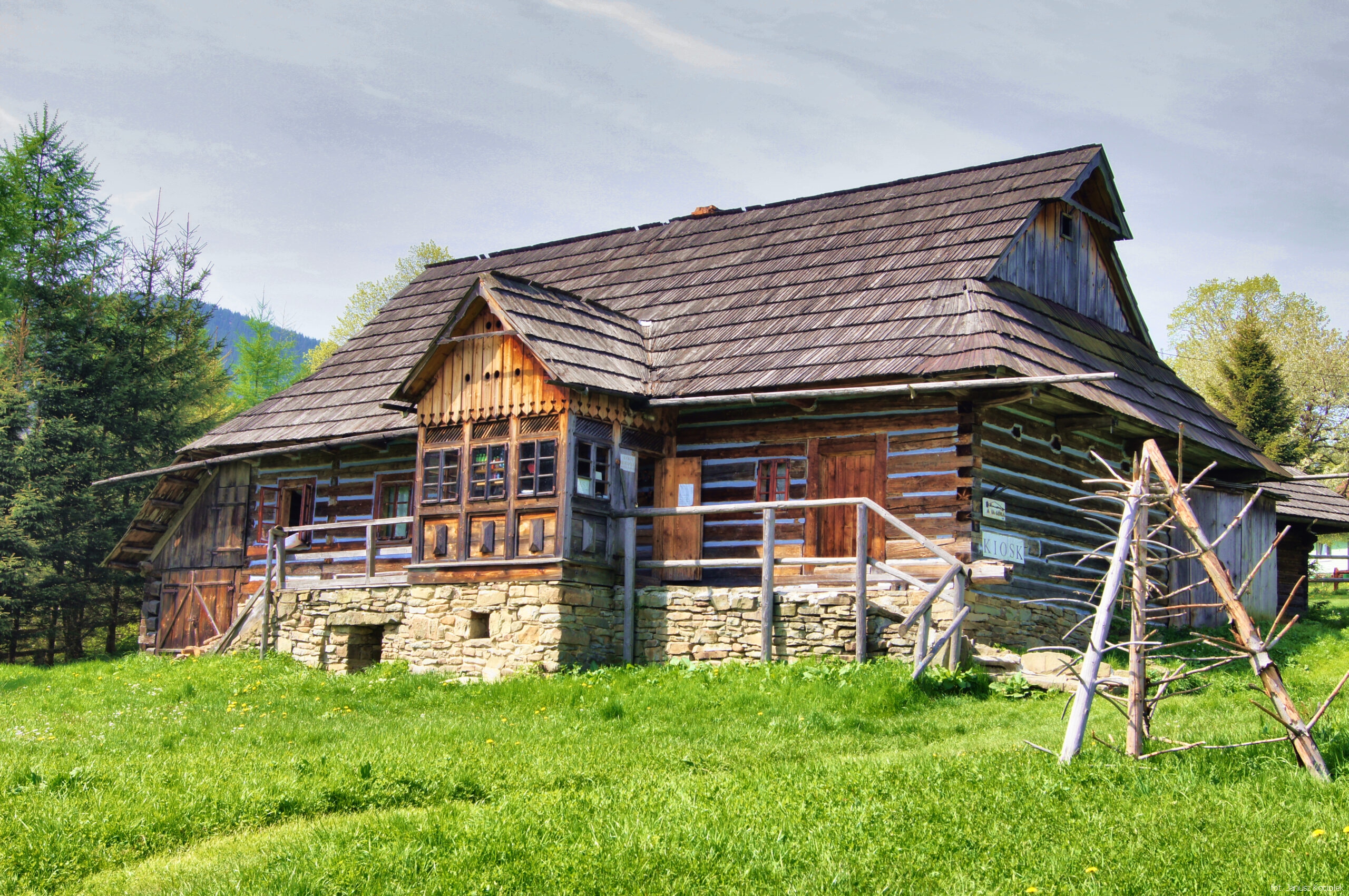
A complex of wooden buildings representing the typical architecture of the region (including the historic Banasik's cottage from 1809). Permanent and temporary exhibitions. Object on the Trail of Wooden Architecture.
GPS: 49°37'11.2"N 19°42'05.1"E 49.619764, 19.701417
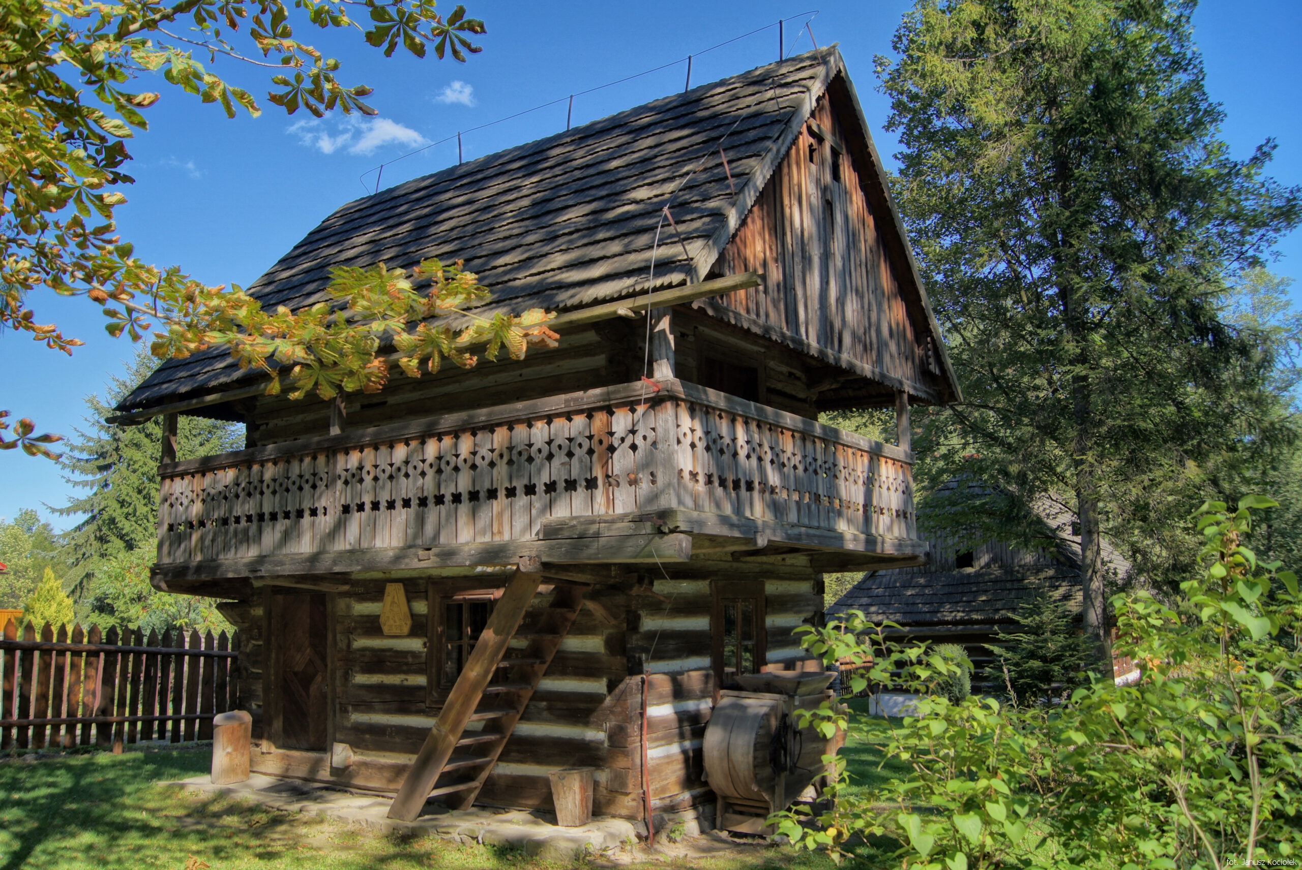
It currently consists of three residential buildings, a smithy, a free-standing granary with a cellar and a chapel with a statue of the Virgin Mary. The oldest object in the ethnographic museum is Stopiak's chimneyless cottage from the years 1802-1815. Object on the Trail of Wooden Architecture.
https://zawoja.pl/skansen-w-zawoi-markowej
GPS: 49°36'26.0"N 19°30'54.1"E 49.607222, 19.515018
It is part of a cultural centre and is situated in a 19th century forester's lodge, which houses a museum of toy-making. The permanent exhibition presents traditional wooden toys, such as horses, rattles, birds, carriages, etc. Creative workshops, educational activities and temporary exhibitions are organised here.
https://www.beskidzkiecentrumzabawki.pl
GPS: 49°42'50.1"N 19°31'18.2"E 49.713921, 19.521707
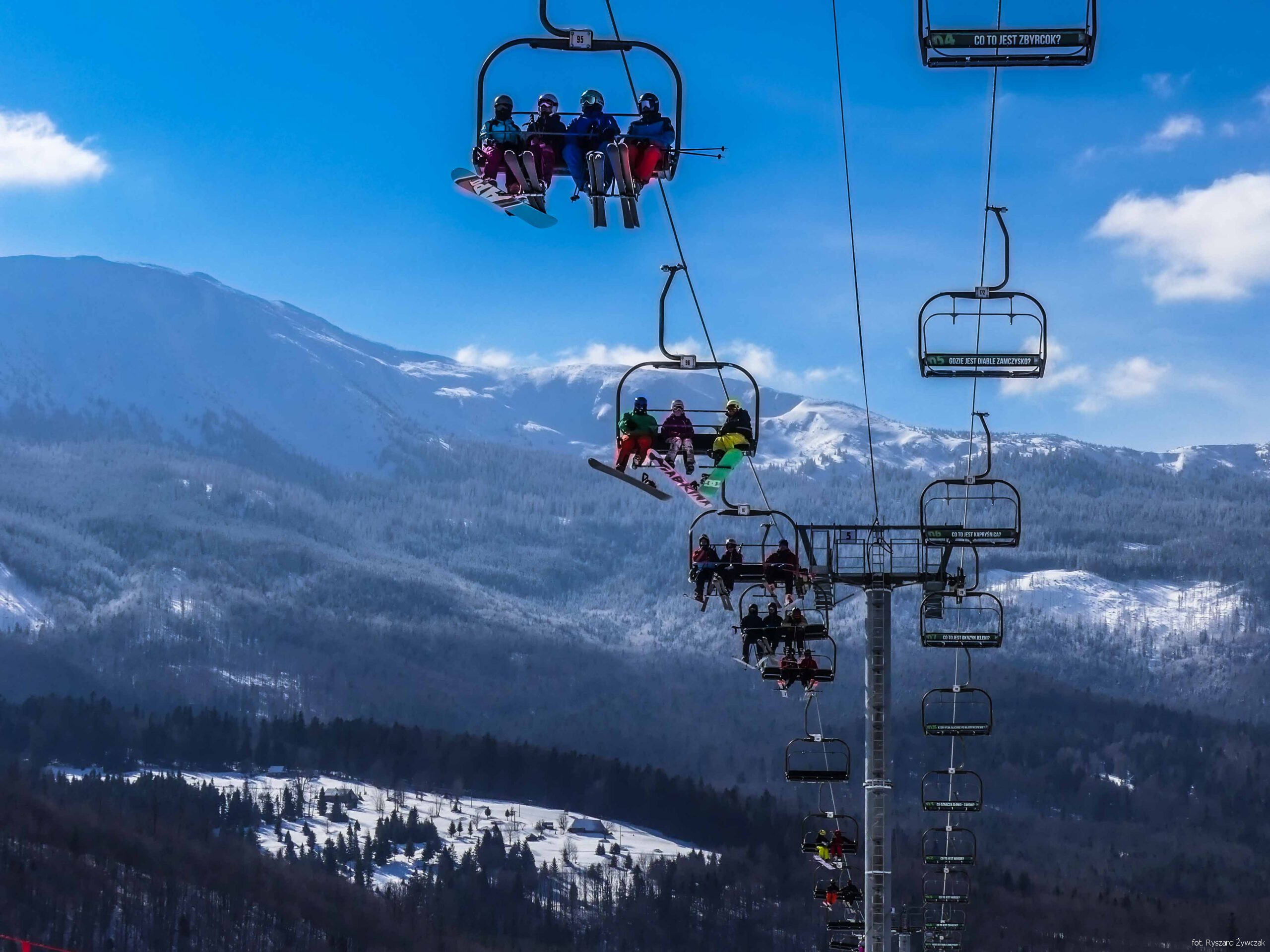
Year-round chairlift with 4-seat chairs to Mosorny Groń (1045 m amsl). The ski slope with a length of 1420 m and denivelation of 336 m has a FIS license. In summer it is used as a downhill cycle track. Nearby there are also other cycling routes (Bike Park, Babia Góra Trails). A beautiful panorama of Babia Góra from the upper station. The view will be greatly enhanced by the newly built (2022) observation tower.
GPS: 49°36'47.9"N 19°33'12.1"E 49.613297, 19.553348
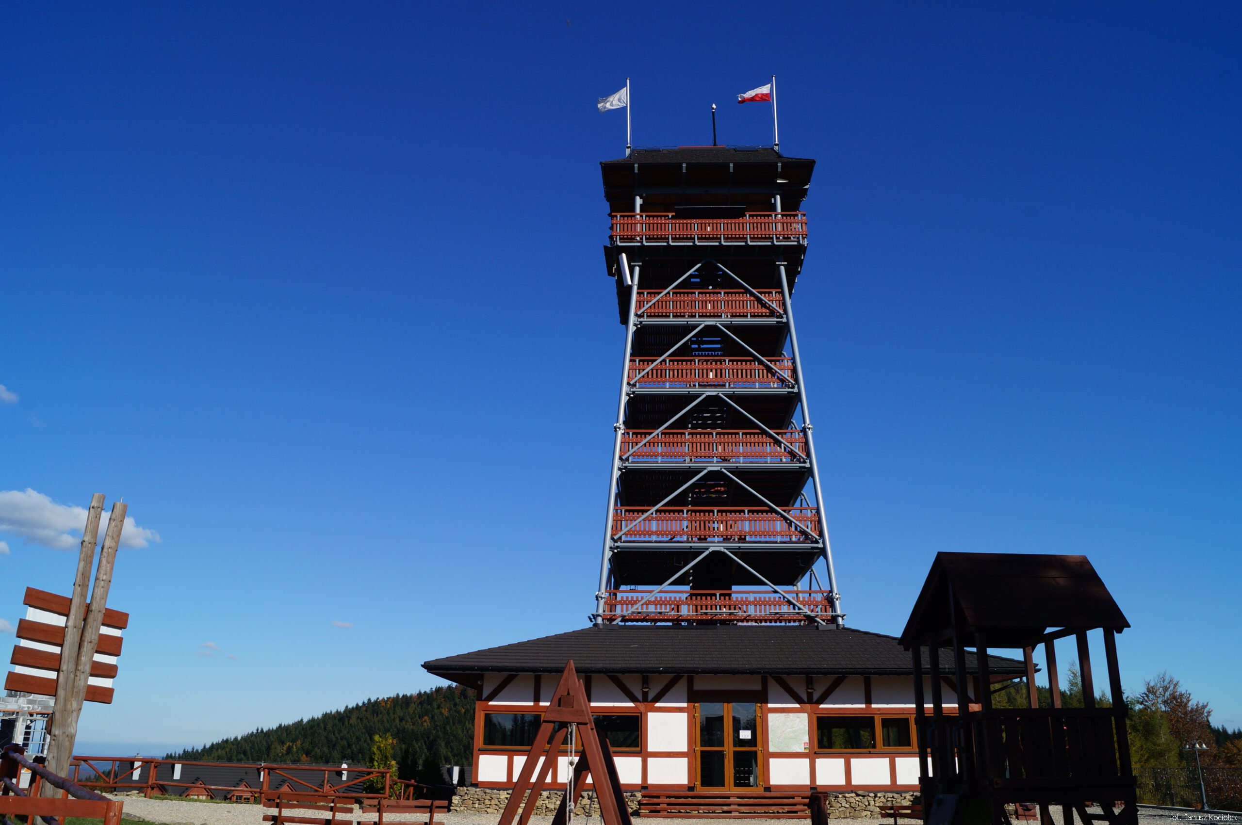
The tower is 25 m high, of steel construction with wooden finishing. Possibility of viewing the surrounding panoramas, including mountain ranges in the Beskids: Żywiec, Maków, Silesian, Little and Gorce. Situated in the hotel complex. Admission chargeable.
GPS: 49°41'57.8"N 19°33'37.8"E 49.699392, 19.560501