Sidzina Wielka Polana (approx. 760 m amsl) – Przełęcz Kucałowa (1170 m amsl) – Polica (1369 m amsl) – Mosorny Groń (1047 m amsl) – Zawoja Mosorne (approx. 575 m amsl)
Walking time: 5 hrs 05 mins
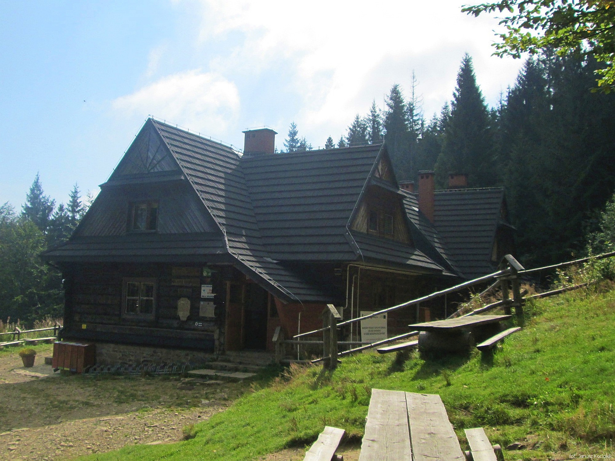
An attractive, varied route leading through the high and stately Polica Range. There are plenty of beautiful views (from the Kucałowa Pass or the Mosorny Groń), valuable forests (forest nature reserves on the Polica), as well as interesting inanimate nature (the waterfall on the Mosorny brook – one of the most beautiful in the Beskid Mountains). On the way, it is worth stopping at the popular PTTK mountain hostel on Hala Krupowa.
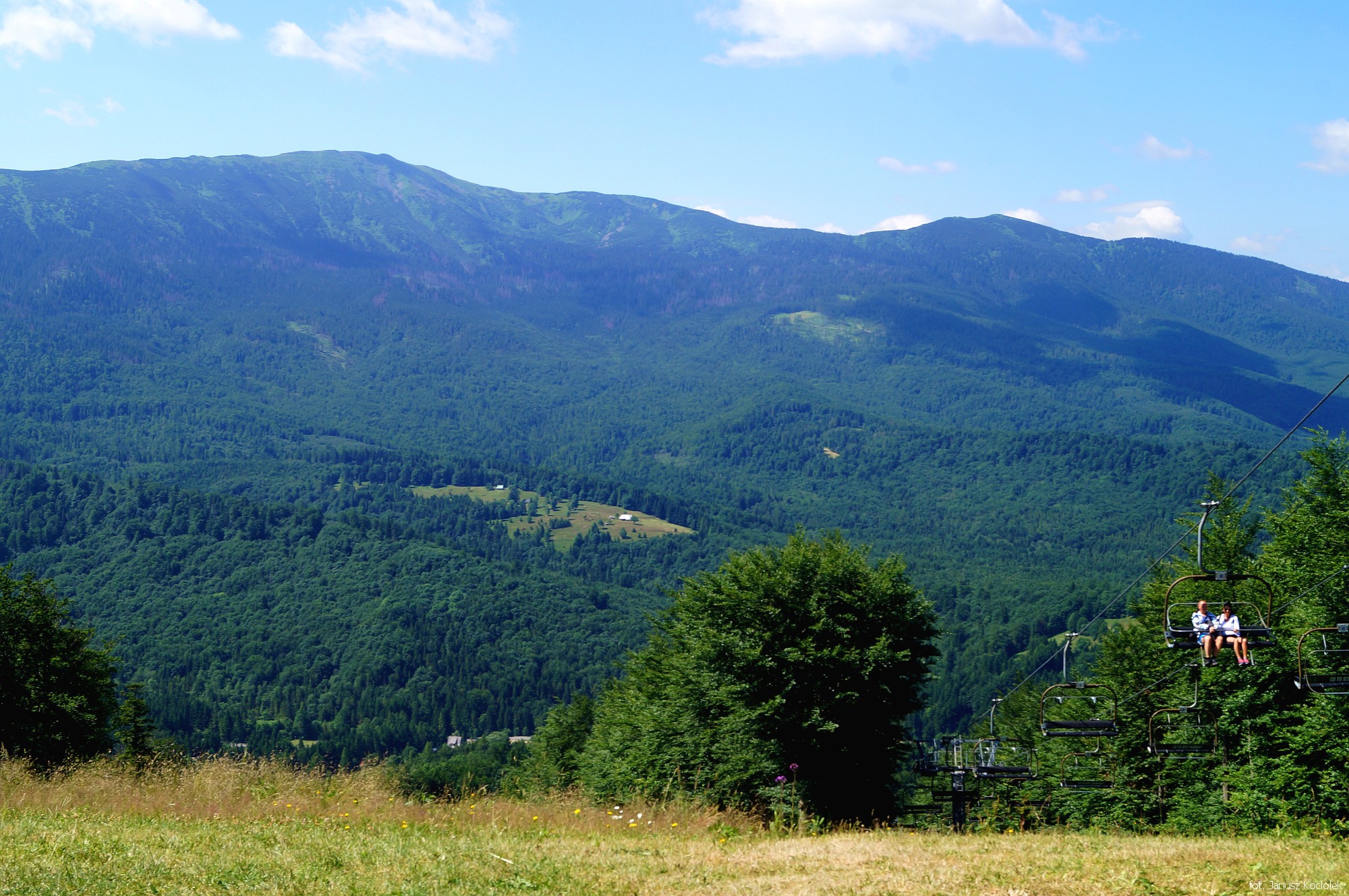
From the bus stop „Sidzina Wielka Polana” by the road Sidzina – Zubrzyca Górna we follow the black trail signs, soon descending to the right to a narrow path. From here we go down steadily, leaving behind the valley of Zakulawka, the so-called Psia Dolina, which before World War II was considered by some to be the most beautiful in the Beskid Mountains. We cross a wide slope road, which we reach again several minutes later. The route descends a few hundred metres to the slope and again ascends the traverse of the ridge descending from Okrąglica, reaching the border of a dense beech forest, along which runs a transverse road and the green trail from Sidzina to Zawoja. Following the black and green trail signs on the left through a low beech forest, we soon get to the mountain pasture and reach the Kucałowa Pass, from which there is a beautiful view of the Koskowa Góra Range in the Maków Beskids, the nearby Okrąglica Mountain and the Orawsko-Nowotarska Valley, closed by an impressive „toothed” wall of the Tatra Mountains. From the pass, the black trail signs lead across the mountain pasture to the visible PTTK mountain hostel on Hala Krupowa
After visiting the mountain hostel we return to the Kucałowa Pass and continue along the red signs of the Main Beskid Trail (and initially also the green ones). The route crosses the peak of Złota Grapa, at the nearest crossroads the route bids farewell to the green trail leading to the centre of Zawoja and through a dense forest and then through a large but already heavily overgrown clearing it reaches the top of the Polica Mountain.

Following the red trail signs, we descend gently to the saddle between Kiczorka and Polica and then ascend to Kiczorka (Cyl Hali Śmietanowej).
Here the route leaves the Main Beskid Trail and follows the yellow trail signs (soon the blue trail joins the route) to the north-west along a steep path among small, mostly withered spruce trees. Finally the route reaches a crossing of trails just below the Mosorny Groń peak. Soon we leave the yellow trail signs and head right along the blue trail, but before we do that we need to get to the near peak, where the upper station of the cable car from Zawoja Policzne.
We return to the fork and follow the blue trail signs to the left. Now a longer descent awaits us, partly steep, to the bottom of the Mosorny brook valley. Hearing the swoosh of the waterfall more and more clearly, the route reaches a place, where a path secured with a wooden railing leads off to the right, directly under the cascade of the Mosorny brook Waterfall.
.

From the waterfall the route follows the blue trail signs along the brook, leaves the forest and reaches an asphalt road through the Mosorne – hamlet of Zawoja. Descend along this road for almost 1.5km to reach the crossroads with the voivodeship road Białka – Jabłonka. Here, at the ‘Zawoja Mosorne’ bus stop, we end the trip.
